 Learning to Burn
Sign In
Module Objective: Knowing where to get the current and forecast fire weather information before you light up
Weather is an important factor to consider when planning your burn. It can change quickly and can catch you out.
It is important to obtain the latest weather forecast for the area in the morning. You need a current and long range forecast, obtained no more than 12 hours before light-up.
Do not light up if:
Continue monitoring the weather forecast during the day and change your plans to suit the weather.
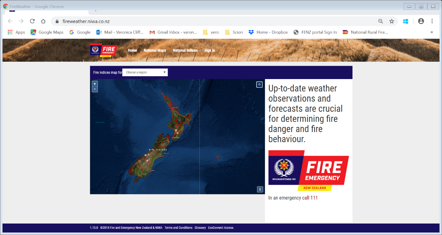
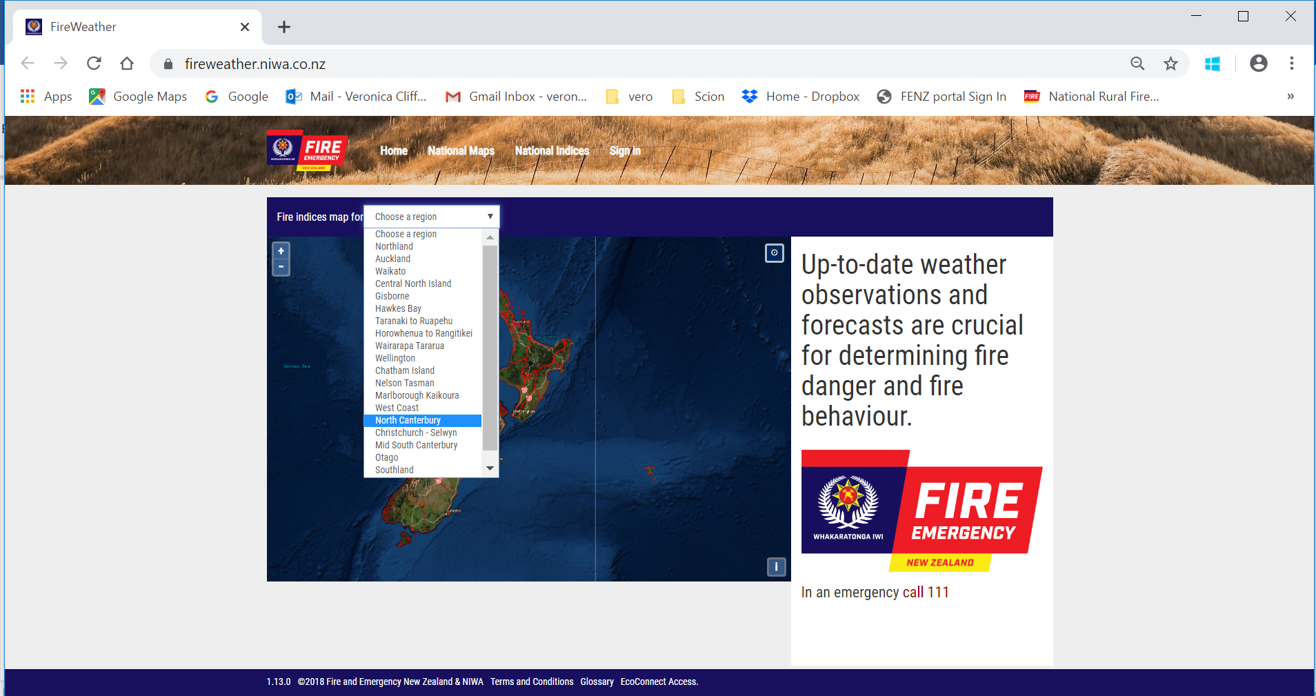
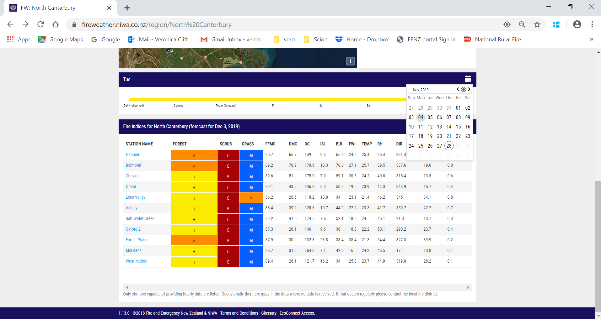
Fire and emergency with NIWA have developed an online website [Click here] which displays the current and forecast fire weather conditions. The website is scalable so works on a PC, tablet, phone or any other device with an internet connection.
The webpage has a Geolocation tool built into it so you can access the fire weather information from the field.
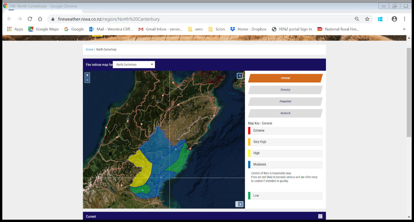
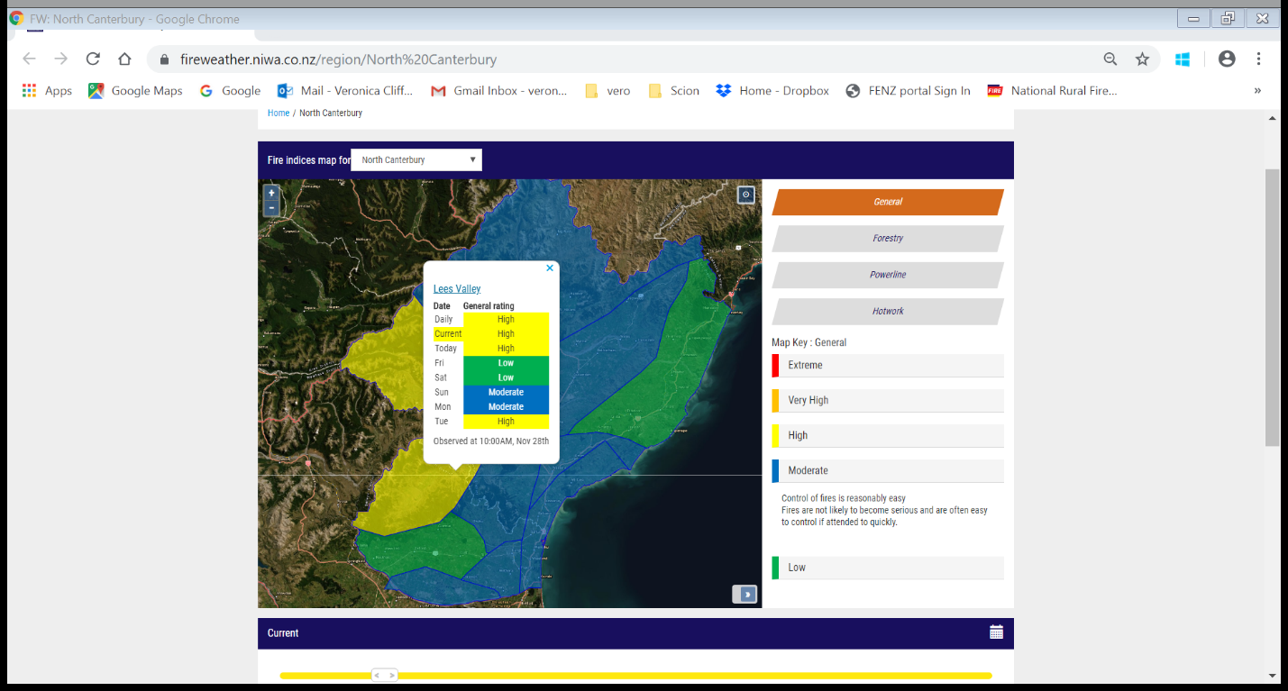
This table shows the fire danger classes for forest, scrub and grass vegetation, along with the fuel dryness codes, and the fire behaviour indices. It also shows the hourly weather parameters that drive these codes and indices. With an understanding of fire behaviour you can see whether it is fuel dryness, and/or the temperatures, humidity and wind strength driving the fire dangers.
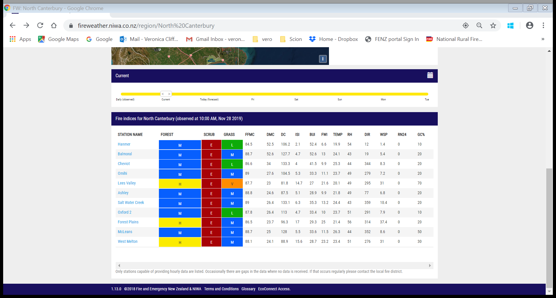
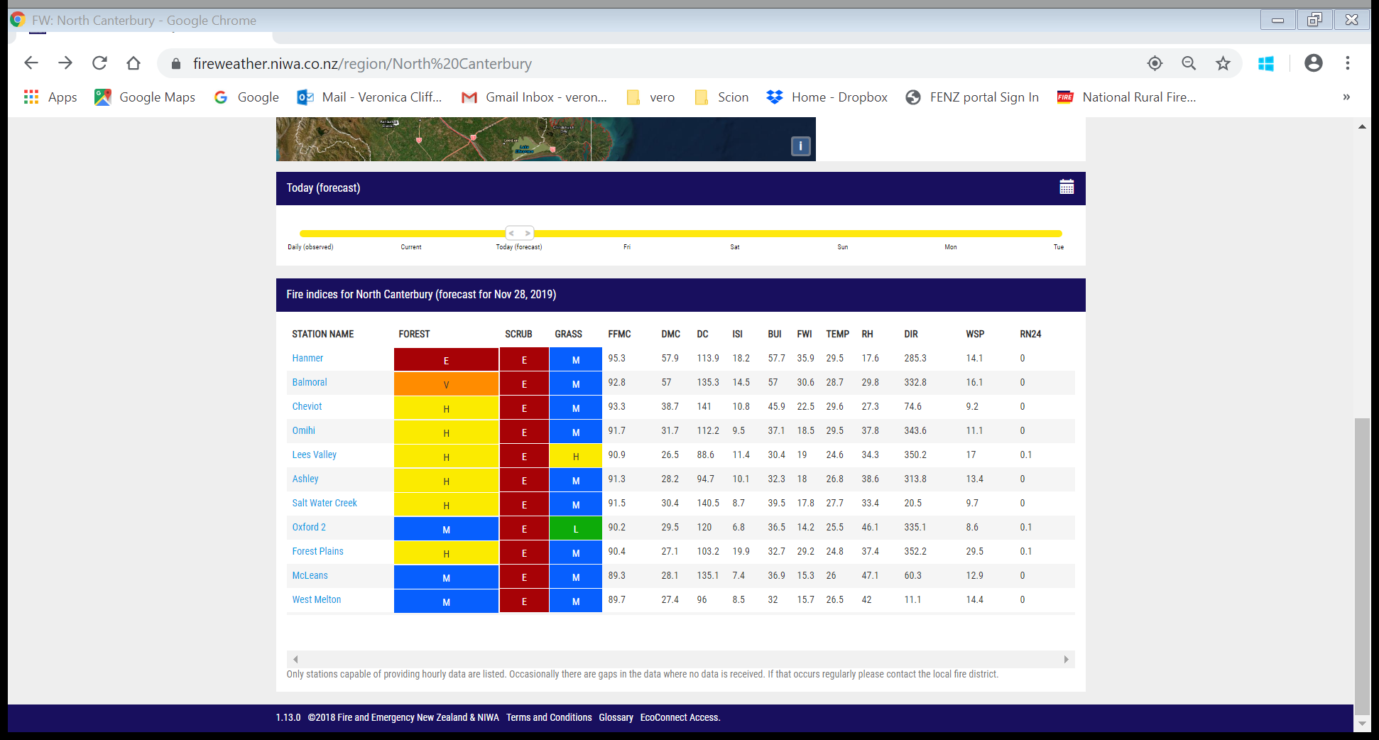
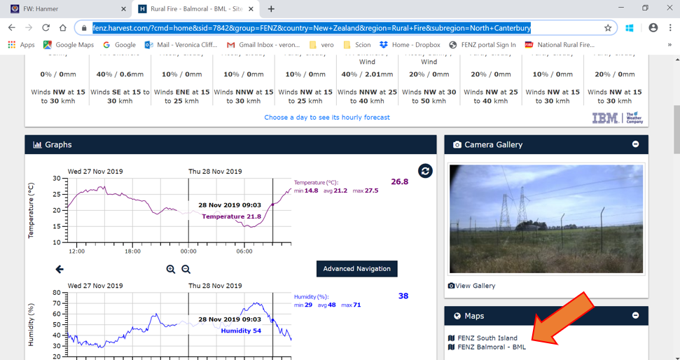
Aside: You can click on the small calendar and can look back at the historical weather for your after-action reviews.
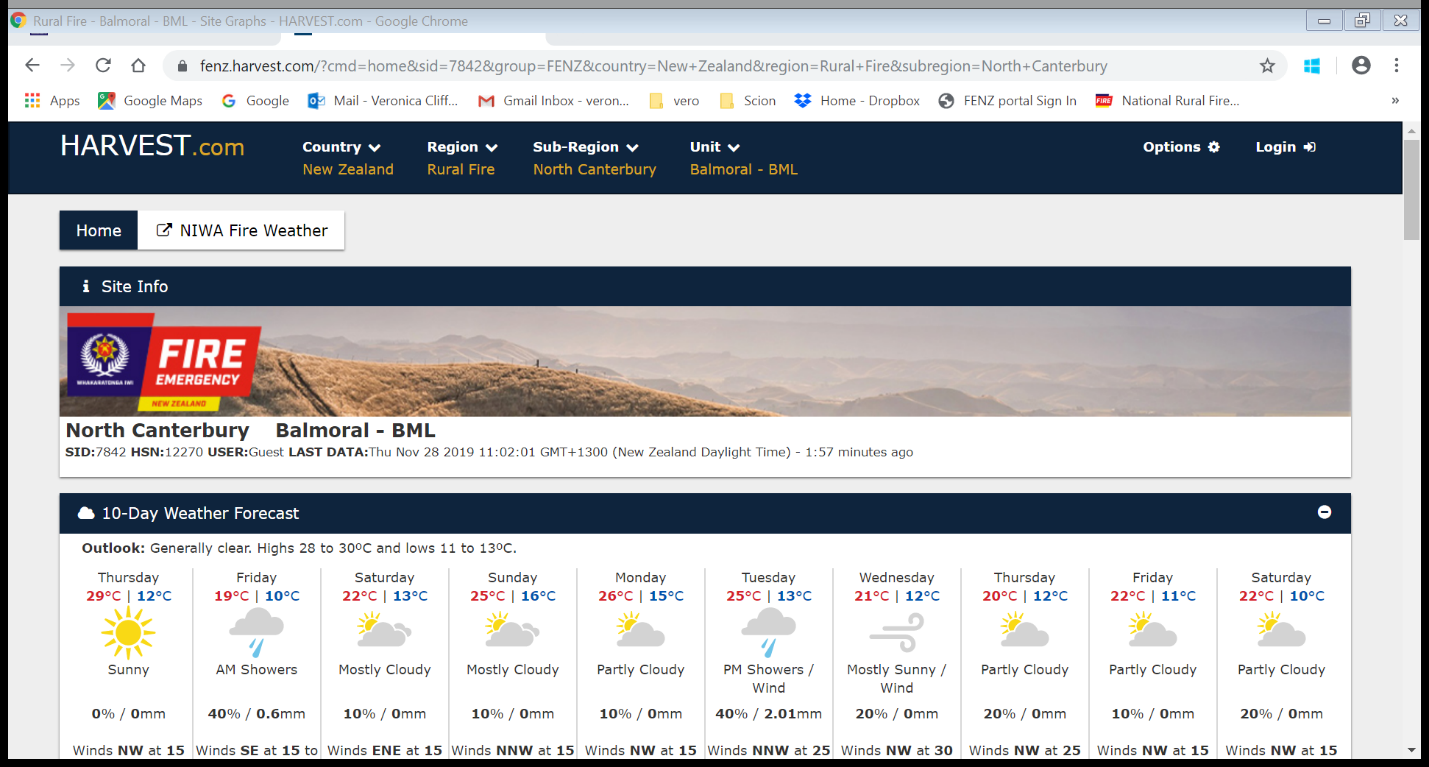
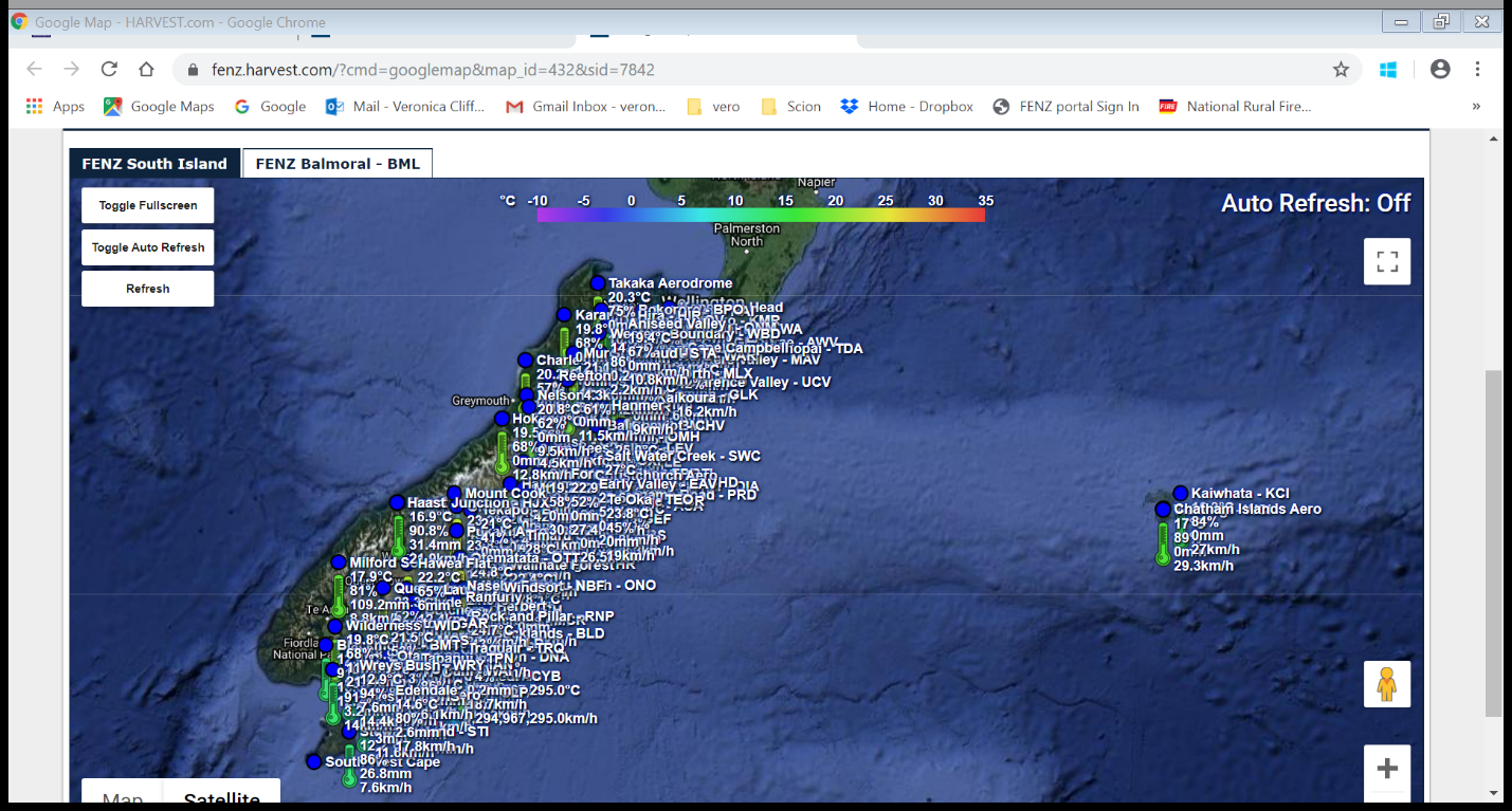
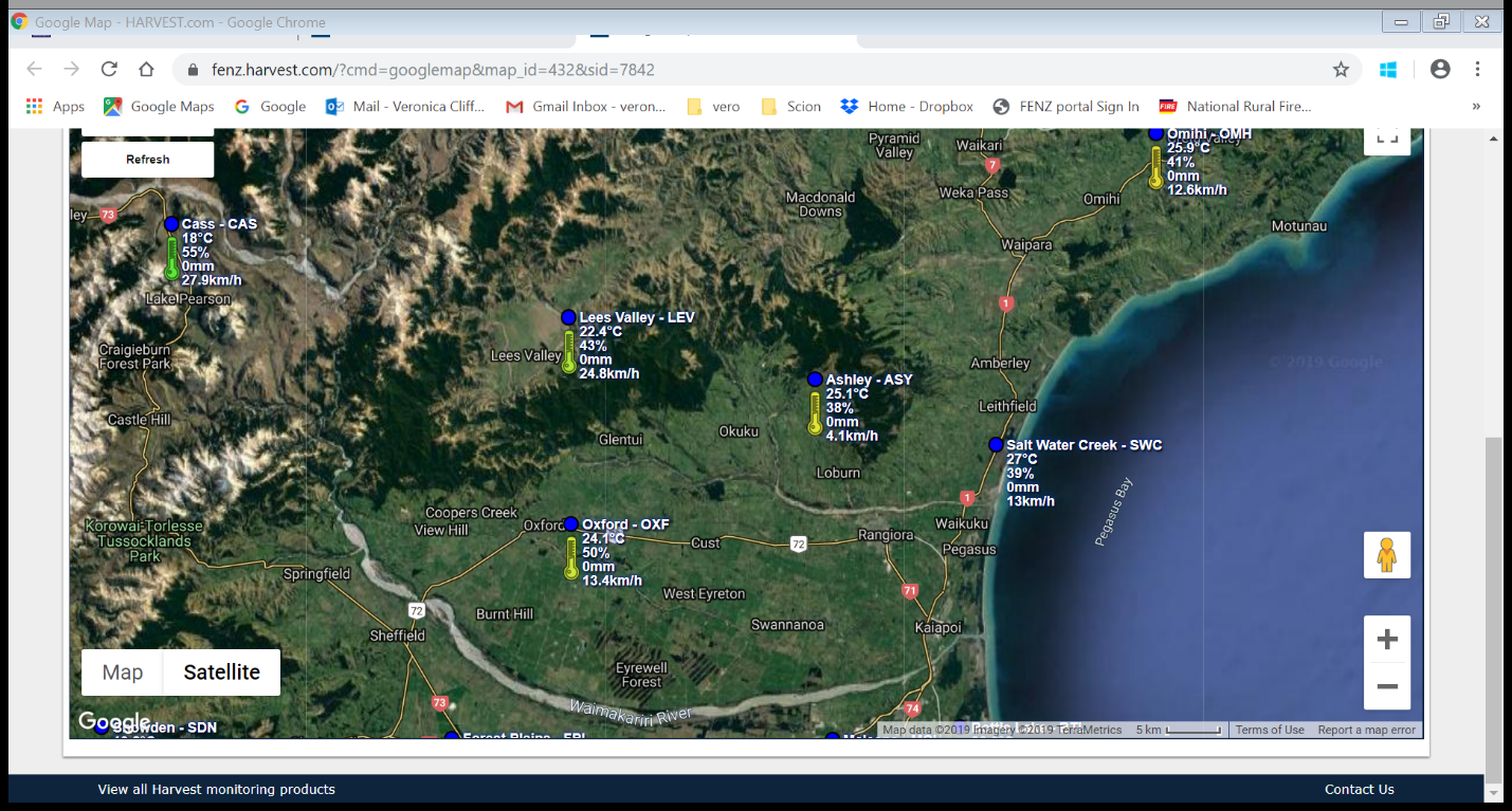
While NIWA and MetService provide good sources of information on weather forecasting, and monitoring the fire danger daily or hourly (NIWA fire website). You can also view more frequent current weather data using the Harvest site. You can track weather parameters from the nearest weather station, which updates every10mins. This site also has basic weather forecasts out to 10 days using Weather Underground.
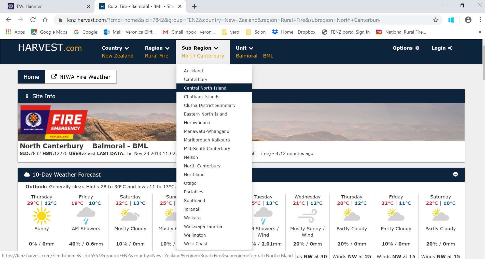
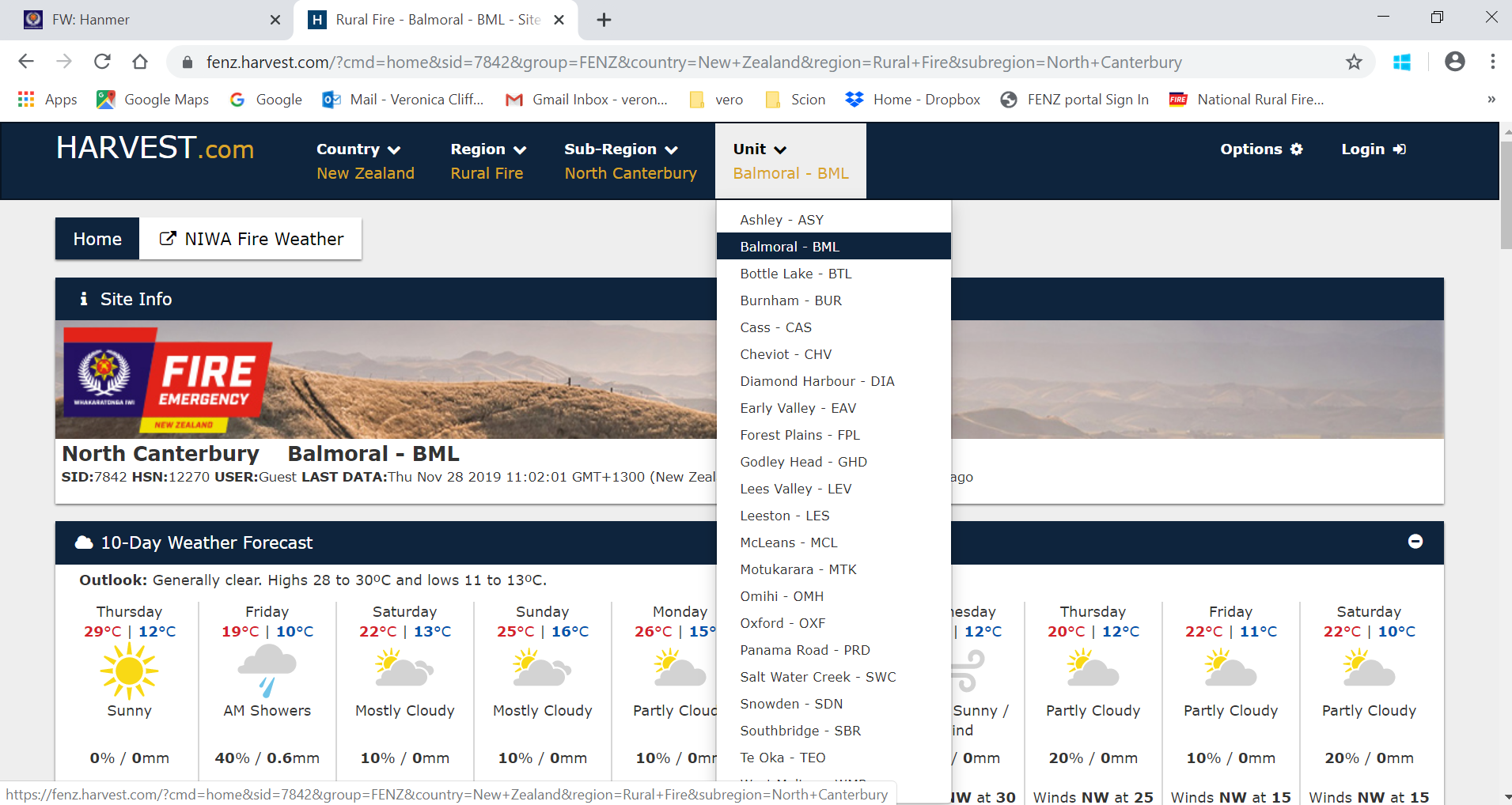
Note: If you are not sure of your nearest unit:
MetService [Click here]
NIWA weather [Click here]
Victoria Uni. MetVuW [Click here]
Need to have a link to the explanation of what the fire dangers mean, and what you can and can’t do, - CROSS LINK TO module on fire codes and indicies
NOTE: video someone going to and getting weather out of these sites for an explanation. With a voice over to explain what and why. Perhaps put on youtuebe or embed these videos
Understanding the need to look at multiple sources and where to get fire weather data (current and forecasted).